What's new in Overland Navigator
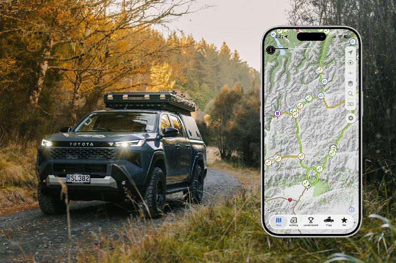
It’s been a busy six months behind the scenes, and the app you’ve got in your pocket today is a fair bit more capable than the one you had at the start of the year. I’ve shipped a stack of new features on both iPhone and Android, given parts of the app a fresh coat of paint, and - the bit a lot of you have been asking for - added heaps of new tracks.
Here’s a round-up of the highlights
Quick summaries of the community’s reviews
Some of the most popular tracks and campsites have dozens of comments and reviews, which is brilliant - but it’s a lot to read through when you’re trying to make a quick call from the side of the road.
So I’ve added AI-generated summaries to track and campsite details. The app reads through all the community reviews and comments and gives you a short, plain-English wrap-up of what people are actually saying - conditions, the gotchas, whether it’s worth the detour. It’s a great way to get the gist in a few seconds, then dive into the full reviews if you want the detail.
It’s live on both iPhone and Android, and the summaries refresh as new reviews come in.
See which tracks are open - and which aren’t
Tracks close. Winter, slips, flooding, managed access - it happens. Now the map tells you about it.
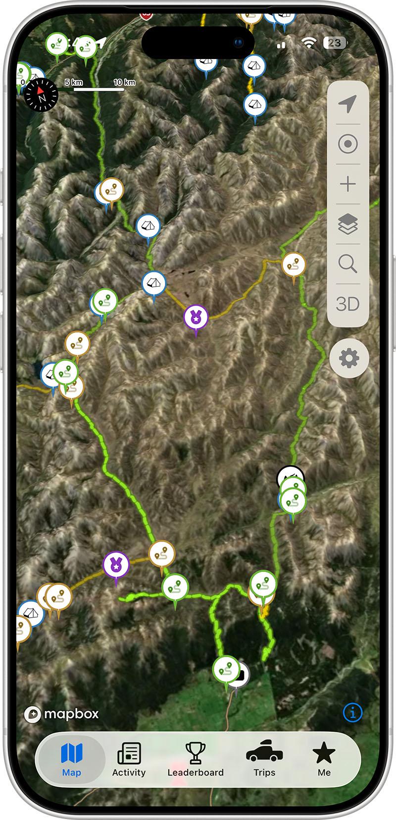
I’ve added open and closed track layers so you can see at a glance where you can and can’t go right now. Closed tracks appear dimmed on the map, and I’ve added support for partial closures too, so a track that’s only shut on one section is shown properly rather than all-or-nothing. Tap into the track details to find out why it’s closed and, where I know it, when it’s expected to reopen.
Passive track tracing
This is a big one, and it’s all about making the map better for everyone over time.
I get out and drive tracks myself to scope and verify them as often as I can - but it’s just me running Overland Navigator, New Zealand’s a big place, and I can’t be everywhere at once. Tracks shift, reroute, wash out and reopen all the time, and there’s no way one person can keep on top of every one of them alone.
That’s where you come in. If you opt in, Overland Navigator can record anonymous traces of where you drive on the tracks. I use these to build a clearer picture of which routes are actually being driven and where they really go - so the routes on the map stay accurate and fully up to date, even on the tracks I haven’t been able to get to myself.
A few things worth saying up front, because I take this seriously:
- It’s completely optional - you choose whether to turn it on, and you can change your mind any time.
- The traces are anonymous and used only to improve the map. I’ve spelled all of this out in the privacy policy.
- It even works in the background and on CarPlay, so it just quietly helps out while you’re out exploring.
Learn more about anonymous route tracking →
Record and submit your own routes
Passive traces work away quietly in the background, but if you want to take a more hands-on role, you can record a route yourself and submit it for the public map.
Hit record before you set off, drive the track, and when you stop the app walks you through a few quick details - name, region, how long it took, the grade, that sort of thing. Keep it private in My Navigator, or flick on Share with the community and it comes through to me for review. If it checks out, it goes up on the map for everyone.
It’s hands down the best way to fill in the gaps - if you know a track that isn’t on there, you’re the perfect person to add it. 🙌
Learn how to record and submit a route →
A much bigger CarPlay experience
CarPlay got a serious upgrade. It’s gone from “the map on your dashboard” to a genuinely useful tool on its own:
- A HUD panel with your key info front and centre
- Route recording straight from the head unit
- Navigator Points and track info on the big screen
- Smoother D-pad panning so you can move around the map without fuss
If you’ve got a Navigator All Access subscription and a CarPlay head unit, it’s well worth a fresh look.
Add your own campsites
You can now add campsites directly from the app. Found a great spot that isn’t on the map yet? Long-press the location (or use the waypoint button), drop a pin, and fill in as much detail as you like - type, amenities, pricing, conditions, photos.
Submit it to share with the community (it goes through a quick review first), or keep it private so it’s just for you. It shows up under My campsites either way. This one’s available on both platforms.
Driver profiles and My Garage
Your profile got a proper expansion. You can now build out My Garage with the vehicles you take out on the tracks - each with a photo and whatever specs you want to add - and link your Instagram, Facebook, TikTok and YouTube.
The best part: when you leave a track or campsite review, you can tag the vehicle you used. That’s genuinely useful for the next person - knowing a track was done in a stock ute versus a built rig tells you a lot about whether it’ll suit yours.
To set it up, head to Settings → Edit Profile, where you can add your bio, build out My Garage, and hook up your social links. Learn more about your profile →
A fresh new look (iPhone)
On iOS I’ve rolled out a refreshed interface using Apple’s new Liquid Glass design - cleaner, more modern, and a nicer thing to use day to day. Lots of little screens got tidied up along the way.
Faster, smoother, and easier to get into
A bunch of less glamorous but very welcome improvements:
- Faster startup - the app loads faster and runs smoother overall
- Better offline maps - improved tile downloading, the newer vector topo style, and offline 3D terrain so the hills render properly even with no signal. Here’s how to download maps for offline use →
Heaps of new tracks 🗺️
If you’ve opened the app recently, you’ve probably noticed the map is looking a lot busier - and that’s not an accident.
Over the last few months I’ve added a huge number of new tracks right across the country, and given the whole library a proper tidy-up while I was at it:
- Smarter grading - I’ve been refining track grades so the difficulty rating you see is a more honest reflection of what you’re actually in for.
- Better descriptions - I’ve gone through and improved the descriptions on public tracks so you get a clearer idea of what to expect before you commit to a day out.
- More status info - open/closed status, seasonal access, and partial closures across far more tracks than before.
There’s a genuine effort going on to make Overland Navigator the most complete picture of where you can actually go off-road in New Zealand - and it’s only getting better as more of you record routes, leave reviews, and add the spots you find. Every track helps.
That’s the headline stuff - there’s been plenty of smaller fixes and tweaks in between too. As always, thanks for being part of it and for all the reviews, photos and submissions that make the app what it is.
See you out there. 🚙💨
Download Overland Navigator and start exploring for free today.
With over 8,500kms of offroad routes all over New Zealand, planning your next offroad adventure has never been easier.